Showing posts sorted by relevance for query earthquake. Sort by date Show all posts

Sunday, October 9, 2016

Sun, Moon and Earthquakes

[Post in development. Please be patient. It will take days until i can get screenshots with the moon for all earthquakes in the 20th and 21st centuries. But from what i've seen so far earthquakes do not occur always when Moon is full or new. I believe statistically without any filters there is still evidence of a link between alignements and earthquakes. But i also suspect if you eliminate cases when alignements occur when moon is farthest from Earth and in an "unfavorable" position.

(Moon does not rotate around Earth in the same plan with Sun but in a tilted one. Also orbit is not circular but elliptical with more than 10 percent difference in diameters.)

https://www.google.com/search?q=moon+motion+around+earth&biw=1215&bih=624&tbm=isch

The best way to prove a correlation i think it would be with the tides. Tides follow closely every variation and cycles of Moon orbit in fact giving a precise measure of the combinations of Moon-Sun gravity effect on entire Earth. Maybe it would be best if i put the screenshots on hold and try to find a link in that direction.

"Several recent studies, however, have found a correlation between earth tides (caused by the position of the moon relative to the earth) and some types of earthquakes.

One study, for example, concludes that during times of higher earth and ocean tides, such as during times of full or new moon, earthquakes are more likely on shallow thrust faults near the edges of continents and in (underwater) subduction zones." https://www2.usgs.gov/faq/categories/9827/3354

The only thing that does not fit with my theory is depth. Aquifers are almost near ground level, at rivers level. Can vibration from a big surface focus deep inside the earth and in the end fool measurements. In fact i really don't understand how they can say the depth of an earthquake if not from calculations between reflection times, phase of the waves etc. but all based on current theories.

I've been looking at a few sides with tide predictions and historic and realized that alone is not what i'm looking for. Calculation of Moon and Sun gravity towards large bodies of water on the surface of the Earth start looking to me like a nightmare. The pull comes from a different direction at every latitude, there is a horizontal and vertical component of the pull. Inertia also plays a role. Without computer simulation taking into account the shape of the body of water, impossible to make a correlation between Sun and Moon gravity and earthquakes.

Even more impossible in a body of water that sits in a sponge like irregular shape geological structure.

In the mean time i'be been thinking. What is the temperature at 100 km or where a deep earthquake occurs. According to google, 25 degree per km, that is 2500 degrees at 100 km? https://www.google.com/search?q=earth+temperature+depth

Lava temperature is about 1000 Celsius that corresponds to a depth of 40 km?

At 2500 most materials known to human kind are melted. How can they say an earthquake occured at 100 km depth or more and still believe in plate tectonics theory?

Boiling water temperature is in an area of just 4 km deep. I've been thinking. We know for a long time about the existence of thermal water. In some places water comes to the surface at high temperature. But imagine what happens when underground water sitting there in hard to imagine shapes of caves and reservoirs together with air bubbles of different pressures, tipped by Moon-Sun gravity and/or inertia moves suddenly into a deep cave or crack like 4 km deep and start boiling? Steam would build up pressure then what? Create a bubble of steam that would come back at the surface at high speeds or cracking the earth even further, collapse caves etc... Sending shock waves in the aquifers and surface... Then cool on its way to the surface and condensate back in the aquifer, like in a cycle.... Create an earthquake? Most likely but that would be indeed impossible to predict...

One thing is sure though. Building dams on aquifers is not a good idea. And aquifers are everywhere...

Mapping the underground with ground penetrating radar and/or other methods like seismic exploration or send robots in the aquifers... Then simulate everything on supercomputers to figure when large amounts of water are about to tip in a deep hot cave... But after such an event the configuration would change... Over and over...

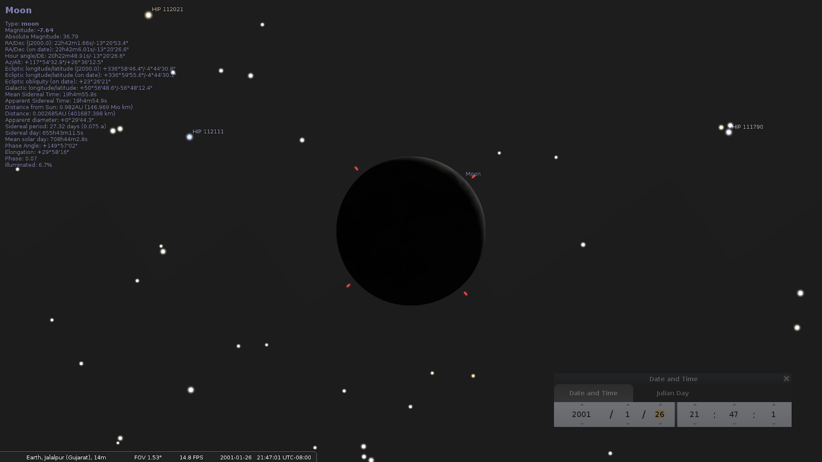
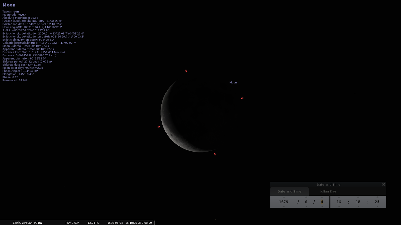
Until i'm done with the screenshots... Anyone can see Moon, distance from Earth and from Sun, and all the other parameters during any earthquake with these simple steps.

Install Stellarium http://www.stellarium.org/wiki/index.php/Installation

Start it.

Hit F11 to get into fullscreen.

Search for the Moon. <CTL><F> and type moon in the search box then enter.

Zoom with mousewheel until you like what you see.

Hit F5 to bring in the time window. Input the date of the earthquake.

Location doesn't matter so much. Moon is pretty much the same on all Earth within 24 hours or so.

But if you wanna be more accurate you can do so by bringing the location Window from the hidden menu on the left.

https://www.youtube.com/watch?v=NOGEyBeoBGM

]


Thursday, August 24, 2023

August 24

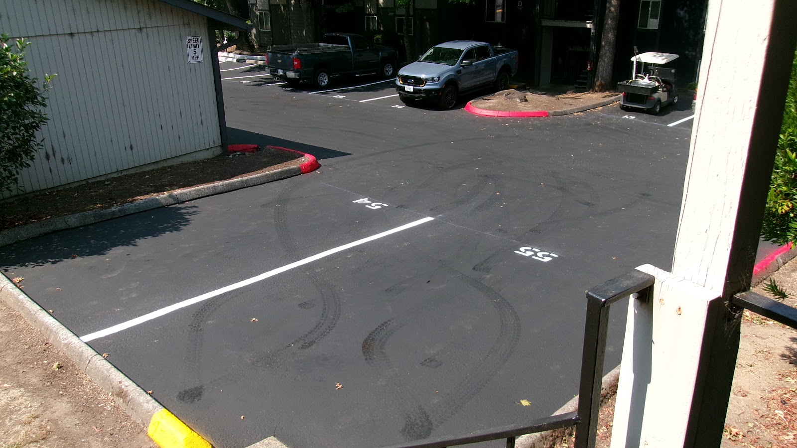
3:03 It is 89 degrees when i finished my walk. Never ending stories. The first thing i noticed when i opened the door where the traces left on the still uncured seal coating. Somebody with a big off road tires 4x4 came sometimes last night and did this.

Could have been the guy with the off road white Toyota with snorkel with LPN unreadable under the windshield that just left when i came. I think they were figuring two infinity signs.

3:07 My truck has smooth tires and is 2x4. It did not leave any traces where i parked this morning when i had to move it from the area they sealed today. The spot is trapezoidal, that is the reason it appears unaligned.

I came the other way as shown the 4x4 came in the picture above and never reached my spot, somebody miraculously moved and made a free spot before i got here. The spot on the right with the traces left intentionally visible (in a "spot crisis" when half of the complex is being sealed) i new in that moment it was a trick, like anything else.

There is painting flaking from my truck from a paint job done at Modern Auto more than 15 years ago. I hit a pole in hospital parking lot with the right rear fender when i drove there, sick. Hood was bent from pushing on it so many times. Left door from stealing my stereo. They knew they were going to let me park there and left some white paint on the new coating.

3:14 They did something similar when the painted the doors and the siding a few years ago. They intentionally left brown spots on the door, as they were working with trainees.

3:22 I got so mad i took the other way, or through the freshly sealed area. Most of it was dry but i ran into a wet area, and because of being so distracted i just thought it was wet with water or something on. Slipped but did not fall.

3:23 During my walk i was thinking. You cannot identifiy a body that is otherwise unrecognizable by a missing finger

I would say the whole story, with the fall of the plane, Putin's reaction, was invented to cover my post, but people would say again i'm on drugs. I was wrong again, don't see the reason for the cover. Unless that person is also involved in the same type of activity on tiktok or other sites, like many others. Even in Romania ex athletes became involved with porn and prostitution.

On the other hand, i would say the level of stress and distraction i'm under is equivalent to being on drugs, but i have my moments of lucidity, especially when i take pictures and write while everybody don't know what to believe (please pardon the Japanese accent).

Easiest explanation. "He's high on drugs" and rest are coincidences or ChatGPT which is a rudimentary form of artificial intelligence to explain to the naive what i'm writing.

Wagner of course stands for all the music videos i post. I know many people post online recipes and stuff, i fell into this fashion and posted some, but not all are in the situation i'm in and i only posted realistic recipes for people who don't now how to cook and that is the majority.

They started the never ending unprecedented Trump scandal (to cover Truman Show).

3:38 It's not only the temperature, it's the circulation of air. Temperature was 76 degrees and i was perspiring from head to toes. So i started the AC that circulates air like a fan.

More Kafka. Got Medicare and everybody knows, the only state insurance in the US, payed by payroll deductions comes without covering dental and prescriptions and others. There are other plans known Medicare Advantage that probably suck the money that otherwise would suffice for drugs and prescription from Medicare, and give those, for free.

Trick is you have to know and to enroll. If you don't enroll soon enough, you will have to pay later a lifetime monthly penalty to Medicare for... not having prescriptions covered.

So i got into one of those called Humana Plus Gold Diabetes bla bla hoping to get some insulin and they assigned me a doctor named... Nicholas Sweet. However he is not a doctor but a physician assistant and he says he did not a contract with Humana in more than a year. All doctors avoid Medicare and Medicare based plans because they slash bills to maybe a third or a quarter.

Trouble is i have to find an "in network" doctor to prove i got diabetes first (GNU). I used to go a  lot to doctors when i had insurance through Angela's work but stopped doing so when i ran into Lady Gaga and her stethoscope in 2011. And of course when i went to the ER with flesh eating bacteria that was never diagnosed right.

Got an appointment tomorrow with the only doctor i could find available in the area after many calls, his name is Michael Jaczko (Billy Jean) also ko or co suffix indicates Ukrainian origin like escu Romanian, ski Polish, etc..

The clinic is under a cell phone tower with (at times) high levels of radiation. Last and only time when i went for the paperwork i forgot to take my meter and got a dose that caused me 48 hours of pains.

3:56 It is incredible how few videos and other credible news come to us from Ukraine. Some would say is for protection of troupes and/or population. Being in Crimea, they put the video. But every time when i was complaining of lack of credible news from the war they started to shell cities at the border with Romania. And then they told us not to post videos or pictures of those for safety of Ukrainians.

7:30 9.3 Indian Ocean Earthquake Or Indonesia Earthquake of 2004 generated waves up to 51 meters high while 9.1 Japan Earthquake of 2011 only 40 meters. However that not explain how the tsunami generated by Indonesian Earthquake reached Somalia across the ocean at heights of 9.4 meters and the tsunami generated by the Japanese earthquake didn't.


7:50 That is also very interesting.

8:00 Was nauseated all day long. Went and picked and threw in the garbage a couple of dog piles from the other end of the building. Just by smelling those from close, an hour later i got belly pains.

8:55 Media Recycling Center.


9:20 Never knew!

Ok so furniture came on July 22, this was recorded on 28 (warning, some offending language) but i'm sure there are other versions recorded in the past. It was a few days after they started to walk and stump. If this is addressed to me, it breaks several local laws. Also, everybody knows, Pikachu and al Pokemons were characters invented in Japan.

Designed in Japan, for American use (like cars) cause Pikachu in English means pick at you, wich means a character based on a kami that may be malevolent depending. Shinto religion does not have a clearly defined concept of good or bad.

11:30 It rains! (Very rare in Oregon in August). Very local, just a cell above I5. Don't know if it's bad or good for the asphalt seal coat or will delay curing. Hope it's going to help with the asphalt smell. Curiously enough, the rain is following the (low pressure) on top of freways. Just another example on how human activity may influence weather. Could THEY have done this to "cancel" the animations above?
No cause i saw the storm coming on satellite animation (got it on my start pages of my browser) before i posted those.

Friday, November 4, 2016

Method of Predicting Earthquakes

There are no known methods for predicting both shallow and deep earthquakes. Plate Tectonics theory (Turtle Earth) that has been accepted by mainstream geologists for so long has failed to produce any prediction mechanism.

Basically there are two different types of earthquakes, deep and shallow and they occur statistically in response to alignments of nearby celestial bodies mainly known to us as phases of the Moon and also to distances Earth-Sun, Earth-Moon. My hypothesis in both cases is the main source of mechanical energy arise from changes of chemical phases followed by changes of volumes in rather large pockets of thermally and chemically homogeneous materials inside the lithosphere for the deep ones and similarly changes of phases and volumes of water (instant or flash boiling) in deep crevices for the shallow ones triggered in both cases by changes of pressure in those large pockets due to ground tides. It seems important to note here the unavoidable coincidence of using the word phase with two completely different senses while describing two different concurrent phenomena and also co-existence of two different types of of earthquakes produced and triggered by similar phenomena at different depths and with different materials.

http://www.physicalgeography.net/fundamentals/10h.html

According to Plate Tectonics theory the plates with known boundaries described slightly differently on many different competing geological maps should be more than the crust, which is 5-70 km thick, and include the solidified part of the mantle together comprising the lithosphere where earthquakes occur.

I hereby submit the so called plates are not made of a contiguous and solid material. They are rather a collection of adjacent thermally and chemically homogenous volumes floating together on the magma and being pushed in the same direction by single horizontal magma convection currents towards areas where two opposed horizontal convection currents meet and move downwards where they [solid material, so-called plates] accumulate and generally raise together upwards, and apart from areas of upward vertically splitting convection currents where are replaced by new solidifying material pushed upwards by upwards splitting convection currents.

In these area where convection currents meet or split there are volumes of thermally non-continuous and inhomogeneous lithosphere with pockets of uniform or homogeneous materials were changes of phase with changes of volumes may occur in the entire volume during heating or cooling due to vertical motion, according to the phase diagrams of those materials, simultaneously or in short period of times that is the duration of earthquakes.

As two large areas of floating lithosphere meet or separate from each other in areas above both upwards and downwards convection currents known from geological observations as faults there are more opportunities for changes in pressure and temperature for the contiguous and homogeneous volumes of magma due to vertical movements and complex 3D rearrangements then in all of other areas of the lithosphere.

However the sudden phase changes in thermally and chemically homogeneous volumes may occur mostly triggered by tipping external factors such as gravitational influences of nearby celestial bodies and atmospheric pressure.

Also the displacements registered by measurements at ground level are very small relative to the enormous size of the plates and could be easily absorbed through plastic deformations by the enormous size of the hypothetical plates.

There are already theories and studies that suggest intraplate plastic deformations may occur.

"The theory of plate tectonics assumes a rigid behavior of tectonic plates and therefore fails to account for observed intraplate deformation. A new theory of intraplate tectonics is developed to calculate the first-order intraplate deformation induced by horizontal displacement of deformable plate boundaries." "The theory indicates that the first-order intraplate deformation is predominantly induced by horizontal forces acting on plate boundaries and by buoyancy forces that arise from lateral density variations between mid-ocean ridges and plate interiors (ridge push). The simplicity of the predictions and their good agreement with observations suggests that intraplate deformation should be investigated in the pole of rotation spherical" A theory of intraplate tectonics. Shimon Wdowinski.

Another argument that does not favor rigid tectonic plate theories is the recorded speed of S-waves in the crust during earthquakes.

There was an earthquake in Nereju, Vrancea, Romania with the following parameters taken from an automated email from USGS:

Magnitude 5.6

Date-Time

23 Sep 2016 23:11:20 UTC

24 Sep 2016 02:11:20 near epicenter

23 Sep 2016 15:11:20 standard time in your timezone

Location 45.723N 26.627E

Depth 88 km

Distances

7 km (4 mi) W of Nereju, Romania

37 km (22 mi) ESE of Covasna, Romania

42 km (26 mi) NE of Nehoiu, Romania

43 km (26 mi) W of Focsani, Romania

149 km (92 mi) NNE of Bucharest, Romania

There are video recordings published on the web from surveillance video cameras in Bucharest that tell the first trembles corresponding to S or shear waves arrived in Bucharest approximately 30 seconds later which corresponds to a speed of 300 km per minute or 5  km/second.
http://teenskepchick.org/2014/12/15/the-physics-philes-lesson-123-conduction-convection-radiation-oh-my/
There are temperature gradients in the volume of the mantle and crust and the continuous raise of the mantle and crust to a higher level may lead to lowering the temperature as the crust is raising. In this way in fault areas atop splitting upwards convection currents at various depths all the way to the mantle massive crevices may occur. At the surface the crevices accumulate and form valleys but deeper the crevices may get filled with water, either from aquifers or from oceans above. Their depth may be corresponding to the depth at which shallow earthquakes appear to be coming from current observations and measurements.

Communication of deep underground water and higher aquifers or oceans may occur through networks of shafts or caves or porous rock. Pressure and level changes of water at the surface may influence the pressure in the deep crevices.

Moon, Sun and other planets' gravity influence the level of waters in seas, oceans and lakes known as tides. Changes of levels in the underground aquifers may occur during passages and alignments of nearby celestial bodies such as Moon, Venus, Mercury and Sun in the same way they occur during ocean's' tides. Changes of levels may lead to changes in pressure all the way to the deep crevices.

Water in deep crevices as described above may be at a depth where temperature can lead to slowly and constantly boiling. However the vapors do not often reach the surface and rather condensate at higher levels and fall back as liquid water back in the deep crevices.

https://en.wikipedia.org/wiki/Phase_diagram

Water boiling temperature is influenced by pressure. Water can boil in vacuum (no pressure at all) at very low or ambient temperatures, at 100 degrees at sea level and up to several hundred degrees at several km deep in the ocean.

Sudden decrease of pressure in a body of water boiling slowly or at near boiling temperature in all volume can cause sudden accelerated boiling in the whole volume with sudden increases in volume due to vapors and pressure known as flash boiling. If this sudden boiling occurs in a massive crevice as mentioned above the flash boiling which is accompanied by increase in volume may lead to expansion in upper crevices through narrow passages producing massive vibrations known as earthquakes.

Following the alignments or phases of the Moon, monthly perihelion of Moon (closest point to Earth), yearly perihelion of Earth relative to the Sun, and other planets' alignements, tides are being predicted for navigational purposes.

I hereby propose the following earthquake prediction mechanism based on the above described boiling water in deep crevices theory: Most probable an earthquake will occur during planetary alignments likely to cause the lowest tides in a hypothetical or real ocean above known seismic areas combined with a sudden atmospheric pressure decrease.

http://www.ucl.ac.uk/EarthSci/people/lidunka/GEOL2014/Geophysics7%20-%20Deep%20Earth/Earth%20Structure.htm
For deeper earthquakes there may be a mechanism similar to water boiling but applied to the overheated magma. Magma is rather chemically complex and has a complicated phase diagram with many phases and transition possibilities from one phase to another that can occur during cooling or changes of pressure sometimes with change of volume.

Changes of phases may propagate suddenly in homogeneous volumes of overheated magmas where favorable temperature and pressure conditions exist as predicted by the phase diagrams of different basaltic magmas and may induce sudden changes in volume that may also lead to earthquakes. These changes of phase may be triggered by rather subtle variations of pressure from any direction including from the surface and induced by the same factors such as gravity of nearby celestial bodies that create terrestrial, oceanic and atmospheric tides and/or by changes of atmospheric pressure.

A very comprehensive and inexpensive way to prove a theory is through applying it to older data.

Last summer there was a series of earthquakes in Italy and Romania that really motivated me to look further into this problem. Especially after i read the news about a possible link between earthquakes and moon phases raised by researchers from Japan.

The issue was not new to me. Years ago where i was living in Romania i was looking into a possible link between earthquakes and atmospheric pressure but more from the point of view of Plate Tectonic theory. Then i thought differences in atmospheric pressure applied on large areas of rigid tectonic plates might transmit all the way to the edge or the place meet that is in fault areas and change the "tension" forces in those areas.

Also years ago when i first installed Linux onto one of my computers which BTW i still use i came across on a rather entertaining free piece of software known as Stellarium, a software planetarium that came with the operating system. That app is not really accurate as it uses only cinematic motion equations in calculating orbits that is not taking into account the very complex influence of gravity of different celestial bodies on each other but while getting accustomed with it i tried to recreate the sky over Iasi, Romania, a city where i witnessed the catastrophic earthquake of March 3rd 1977 in Vrancea, Romania. Because then i was impressed with the sky immediately after, the strange little cotton balls covering the whole sky cloud formation and the full Moon above which remained in my memory. Recently and independently from the current news about the link between Moon phases and earthquakes i verified this hypothesis with Stellarium on other earthquakes and Moon phases.

Then this year i started downloading data from USGS and making tables and adding Stellarium screenshots to those and figured there was a very strong correlation between the two. Because i could not reach past databases with synoptic maps with atmospheric pressure i was watching the newly occurring series of earthquakes in Romania and Italy and used a meteo prediction web site to see if there is a link with the atmospheric pressure. It was confirmed earthquakes occur only when there is a decrease in atmospheric pressure correlated with alignments of Moon, Sun and Earth.

More recently i tried and downloaded the whole list for earthquakes greater than 4 in Romania from USGS database. I uploaded it then to a spreadsheet and added columns for Moon age (days since New Moon), phase of Moon, distance and hour of each earthquake in that list. Since linear formulas for moon age were not accurate enough i added manually the Age of Moon in days and fraction of days from sites that claim higher accuracy.

Then based on the data gathered i started to build simple histograms counting earthquakes in relation to Earth-Moon distance, time of the day, day since new moon, etc.

All the data i studied so far especially the list of earthquakes greater than 4 in Romania i attached here though it didn't lead immediately to a very precise prediction algorithm is encouraging me personally enough into believing such correlations exists.

As a work for the final purpose of finding a precise prediction algorithm, factors need to be separated from each other, influence from atmospheric pressure data need to be added and analysed after gathering that data and generally more data needs to be gathered including meteorological data and everything must be processed with more advanced statistical analysis software including AI or machine learning algorithms on performant computers.

As i stated in one of the paragraphs of this project's description i agree that the the best way to study a correlation would be adding historical data from oceanic and terrestrial tides combined with atmospheric pressure to existing earthquake databases as tides are a good measure of the combined gravitational forces acting upon one location of the earth at a certain time and combined with changes in atmospheric pressure possibly triggering earthquake events according to the theory of phase changes or any theory that accepts earthquakes can be triggered even by subtle variation of geological forces such as tensions in tectonic plates though external influences such as nearby celestial bodies' gravity and atmospheric pressure with the separation and isolation of each influencing factors through statistical methods.

There are a couple of problems though related to correlation between tides and earthquakes as oceanic tides are confined of course to oceans and though they are a good measure of combined gravitational forces, other forces interfere like inertia and/or tidal waves in vast oceans. Also tides of course do not occur on continents except in seas nearby seismic areas and they are not always close enough.

From what i know there is no database for terrestrial tides as i think nobody has been interested in though NASA might have some data on those.

In conclusion i think the best way to pursue the correlations with the influence of combined gravitational forces of celestial bodies on triggering earthquakes is by finding from existing knowledge in universities, space agencies and generally astronomy resources and ultimately isolate formulas that would give a way of calculating total gravitational forces and variations of those forces at time and place of earthquakes in current databases. This can be done following existing knowledge and research and adding those to this project.

As for the atmospheric pressure data, the best way would be to download databases from known sources.
Friday, May 31, 2024

May 31

12:15 AM Here is a snapshot of the 2019 July eq. Hour was 20:19, so the dots are significantly higher on  the diagrams. There was a smaller one right before, i will do that one tomorrow cause i think it happened at low pressure.

During this time of the year is most likely an eq will occur on West Coast, according to this theory to which i concur. However, i think atmospheric pressure is a factor. According to my theory, an earthquake may occur during the highest/lowest tides period of the year. So we got two days with highest probability, 4 and 5 June during low tide.

However keep in mind that 7 days atmospheric pressure forecasts are only 80% accurate towards the end of  the interval. I will update the post when we are within 3 days of the forecasted pressure drop.

Other factors i can think of are winds creating stationary waves and/or heavy traffic.

I tried to do my best before the window so i did it all manually with screenshots and stuff, because i am way behind, trying to do something automatic without any financing.

Also have a problem with my browser, it looks like i got at least a remote viewer on it. I tried everything to fix it. Need to reinstall Windows, tomorrow.

5:45 Hoping i'm gonna sleep better after it, i done a search... Then i looked in the blog and fb. The first time i publicized this was December 2016. I swear i had no idea... However, i wrote a bunch of stuff on g+, which i downloaded all before it went out. Maybe i should revive my old computer and look for it...

But i don't believe it really matters cause nobody will ever give me credit. And on top of everything, my theory also rebukes the tectonic plates theory... Also would not change the reality we're all facing...

Nevermind, it looks like the first time i wrote about this was October 2016 but at that time i did not have the connection with atmospheric pressure which came about one month later...

And one thing... How come NASA never turned this research into something real? And though i can't read the article, i bet they didn't quote this... Of which i didn't know myself until very recently...

6:12 Should have done it last night... It's either my browser is acting up or their server crashed...

Wondering why LOL. But i can do something. Look at the two charts and imagine the cursor also at July 4th, at 10:33 a.m. PST. Is PST the same ad the time used in the charts? And one more thing. Oceanic (and atmospheric) tides are behind terrestrial tides, by hours, according to some authors, and by minutes, according to others...

So both eqs in July 2019 happened on low tides. And yes, the periodic variations of BP (barometric pressure) are also due to of atmospheric tides (same Moon-Sun gravity acts on the atmosphere as well).

For prediction, should do charts for two days only for better resolution, but their server is now down...

8:00 AM Ever since i finished posting the above a song is playing in my head. The song was released in 1976, a year before of the great earthquake of 1977 Romania, which changed the course of history of Romania and Eastern Europe. "Pacepa defection" occurred one year later. (BTW he could not have written that book, it takes many years of immersion in American culture and English language and experience to be able to do that).

I was at the end of one week in bed due to flu, mainly due to poor nutrition, smoking, weather, and in that day (when i was getting better) i was reading in an almanac (by Romanian definition) about an ancient device for establishing an earthquake direction in China.

The song was played back then on Romanian radio and in discotheques. Is the conductor of that band Japanese by any chance?

Round face, what a looker, blue dress with fluffy little clouds like spots.

08:28 PM NASA says 50 minutes. But you know what? I can make a rough idea. I get the culmination hour of the Moon with Stellarium and then i look at tide heights.

Nevermind, i figured it from here. But it looks like i have to install Windows again cause it started again to double the links, and this happened after i re-installed Stellarium.

But before i do this, one more screenshot. According to this site, there is an almost 4 hours lag between Moon culmination and highest tide in Los Angeles. However, in Astoria, Oregon, the lag is negligible.

I guess in some place in between it could be 50 minutes. Why is this important? Because every time you look at a tide diagram in Los Angeles, you should look 4 hours behind the earthquake.
10:30 It was not Stellarium. It is Chrome itself. After i finished installing Windows (PC reset), unlike the first time today, it said could not update Chrome, should go and download it. It wasn't doing it before i did that. Doubling links that is.

Monday, April 8, 2024

April 8

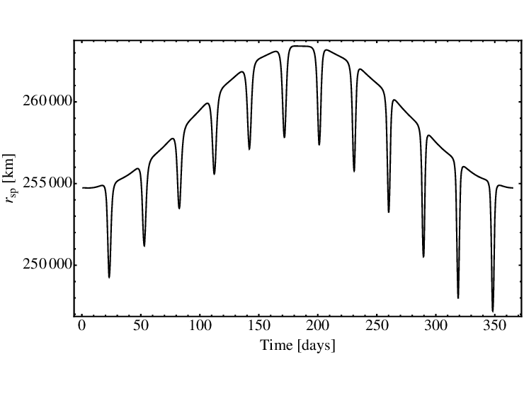
2:14 Research Gate is a serious site with articles written by real scientists from around the world. Here's a diagram with distance Earth Sun. I knew the distance varies due to gravity pull of the Moon when it rotates around Earth. Actually it varies a lot or by 2.5% on average. There is another variation of Earth-Sun distance which happens yearly, with a low at the beginning of the year and you can see the two combined in this diagram.

It is  the only one i could find on internet. However i wish the diagram would allow me to see more precisely the distance in a certain day of the year. It will be logical to have a correlation between the phases of the moon and this diagram.


Earth-Moon distance is changing because Moon also rotates around Earth on an elliptical trajectory, like Earth around Sun, with Earth in one of the two foci. While the axis of alignment Sun Earth Moon rotates 360 degrees during a whole year, the two axis of the Moons ecliptic do not, hence the one cycle difference.

Thus changing distance does not coincides with phases of the moon. There is a shifting phase difference.

Here is a list with the major earthquakes in 2014. You can look for correlations and it looks like most occurred when moon was closer, either near full or near new moon.

By looking at this diagram which is a 2D projection of the plane at an angle which is most familiar, one can easily understand why i mistakenly said earlier Earth is closest to Sun at equinoxes.

However, tides which are again a measure of the gravity pull of Sun and Moon combined, are indeed higher during this period. And northern hemisphere is indeed closest to the Sun. Though it keeps inclining towards it, after, due to the tilt, the distance increases due to ecliptic.

7:56 Barometric pressure history in Hunterdon County NJ (where the April 5 earthquake occurred). Tide levels in the same period. Higher tides indicate a more significant pull of Sun and Moon gravity with lowering of the pressure in Earth's mantle.

Friday 5 (earthquake day) saw a rise after a very rare low barometric pressure.

Tide levels in Atlantic City, NJ around April 5 earthquake.
Spring tides in Atlantic City, NJ. (Max display on the site period is 30 days).

Friday, May 24, 2024

May 24

12:11 Wages and grants. Unsolicited proposal.

1:00 PM Hey now.

1:04 Deb Haaland.

1:20 The idea behind ShakeAllert implemented by Christina David Applegate comes from one of my blog posts since 2016. The blog post is actually made of a failed grant application later in 2017. No matter how much i try i can't find his age to prove who he really is.

1:52 PM

Re:
Inbox

Mahoney, Laura <lmahoney@usgs.gov>
Mar 8, 2017, 7:11 AM
to me, Jill, Jane, Margaret

Hi George,

Submission of an unsolicited proposal does not guarantee that you will receive an award.  Our authorities are what they are.  No rules were changed.  However, I will ensure that the Guide revision is clear in stating those authorities.  If you are interested in working with our earthquakes program, then I suggest that you contact that office directly.

https://earthquake.usgs.gov/

Thanks,
Laura


On Tue, Mar 7, 2017 at 1:39 PM, George Ion <george.ion.email@gmail.com> wrote:
Mrs. Mahoney.

My mistake. How could i have known though since you don't have a separate list for approved unsolicited grants.

As far as applying for the competition. I would not simply because my whole application and method is based on a theory that goes against the official Plate Tectonics theory that i cannot accept given the summum of my technical and scientific background. I would not stand a chance in a competition with geologists who have built a whole science (unfruitful yet) on this theory with chapters and sophisticated terminology i am mostly unfamiliar with.

Besides in a competition you probably don't have to motivate the reason for denying an application as you would for a separate application for an unsolicited grant.

My opinion is you simply changed the rules so you can can pass my application to the competition where you can handle it in a different way.

Sincerely,

George Ion

On Tue, Mar 7, 2017 at 6:39 AM, Mahoney, Laura <lmahoney@usgs.gov> wrote:
Hi George,

Yes, G16AP00023 is a grant that was awarded through the competitive Earthquake Hazards Program.  Unsolicited proposals are considered noncompetitive; and therefore, USGS is limited to our noncompetitive authority of 43 USC 36d for financial assistance.  This is why the letter you received suggested that you reapply through the competitive program which is subject to different authorities.

The Earthquake Hazards competitive program announcement should be posted on www.grants.gov sometime this month.  You should search under CFDA 15.807.  For your reference, I have attached a copy of last year's program announcement.  If you have questions about your eligibility for the competitive program, I suggest that you e-mail gd-erp-coordinator@usgs.gov.

Laura


On Mon, Mar 6, 2017 at 10:52 PM, George Ion <george.ion.email@gmail.com> wrote:
Mrs. Mahoney.

Is this a grant?

G16AP00023 Elizabeth Hearn Southern California Kinematic and Dynamic Models of the Southern California Lithosphere: Applications to Estimating Crustl Stresses and Stressing Rates ($28,600; January 2016 through December 2016) Elizabeth Hearn Final Technical Report due March 2017 2016

On Mon, Mar 6, 2017 at 12:50 PM, Mahoney, Laura <lmahoney@usgs.gov> wrote:
Dear George,

The Guide does comply with the Federal Grant and Cooperative Agreement Act of 1977 (31 USC 6301-6308), which explains the differences between contracts, grants and cooperative agreements.  Each agency has its own unique authorities pertaining to financial assistance.  As stated earlier, individuals are included in the Guide because individuals may receive contract awards.  The revision will clarify the USGS authority for noncompetitive financial assistance awards (43 USC 36d), which only authorizes USGS to give cooperative agreements to Federal, State and academic partners. 

This was the first time that I have received an unsolicited proposal from an individual since taking over this duty.  I did not write the original Guide, but will ensure that future versions will eliminate any confusion on the types of awards individuals are eligible to receive. 

Thanks,
Laura

On Mon, Mar 6, 2017 at 1:54 PM, George Ion <george.ion.email@gmail.com> wrote:
Hi Laura.

So all these years since 2003 the guide or "handbook" for unsolicited proposal printed or at this address https://www2.usgs.gov/contracts/unsolbk.html was all wrong and non conforming with Federal Grant and Cooperative Agreement Act of 1977 (31 U.S.C. 6301–6308), and after i applied on January 20th this year you figured that out?

"I'm currently in the process of revising the "Guide for Submission of Unsolicited Proposals" and clarified this issue in that draft."

George Ion

On Mon, Mar 6, 2017 at 10:04 AM, Mahoney, Laura <lmahoney@usgs.gov> wrote:
Hi George,

Contracts may be made to individuals.  However, the program office that reviewed the application did not recommend funding for your proposal as a contract, but suggested that it be resubmitted through the competitive financial assistance award process.

USGS does not have authority to issue sole source grant awards, nor do we have the authority to issue financial assistance to individuals.  The USGS sole source authority for financial assistance awards is 43 USC 36d, which states:

Notwithstanding the provisions of the Federal Grant and Cooperative Agreement Act of 1977 (31 U.S.C. 6301–6308), the United States Geological Survey is authorized to continue existing, and on and after November 10, 2003, to enter into new cooperative agreements directed towards a particular cooperator, in support of joint research and data collection activities with Federal, State, and academic partners funded by appropriations herein, including those that provide for space in cooperator facilities.

I'm currently in the process of revising the "Guide for Submission of Unsolicited Proposals" and clarified this issue in that draft.

Please let me know if you have any further questions.

Thanks,
Laura


On Thu, Mar 2, 2017 at 7:40 PM, George Ion <george.ion.email@gmail.com> wrote:
Mrs.Mahoney

Thank you for confirming receiving my application dated January 20th. I hope you received all the documents as my resume was sent separately in a different envelope. Also thank you for your card included in the envelope from where i could find this email address. I will try and follow your recommendation and apply for the anual competition because timing seem to be just right.

However in the USGS web page titled "A Guide for the Submission of Unsolicited Proposals" https://www2.usgs.gov/contracts/unsolbk.html#SUBWHEN it is stated: "Awards are made to those organizations and individuals" https://www2.usgs.gov/contracts/unsolbk.html#SUBWHO and "Proposals may be submitted for consideration any time during the year." https://www2.usgs.gov/contracts/unsolbk.html#SUBWHEN

Can you please help me with the confusion created by this apparent contradiction.

George Ion


--
______________________________________

Laura M. Mahoney, CGMS
Grant Analyst
Office of Acquisition and Grants
U.S. Geological Survey
12201 Sunrise Valley Drive, MS 205
Reston, VA 20192
(703) 648-7344 Phone
lmahoney@usgs.gov

The following is for internal USGS only.  This is your invitation to complete a survey that will help the Office of Acquisition and Grants (OAG) track and improve customer service.    Take the Survey

For questions regarding acquisition or financial assistance at USGS, see Contracts and Grants Information (External) or the Acquisition Operating Procedures (Internal)


--
______________________________________

Laura M. Mahoney, CGMS
Grant Analyst
Office of Acquisition and Grants
U.S. Geological Survey
12201 Sunrise Valley Drive, MS 205
Reston, VA 20192
(703) 648-7344 Phone
lmahoney@usgs.gov

The following is for internal USGS only.  This is your invitation to complete a survey that will help the Office of Acquisition and Grants (OAG) track and improve customer service.    Take the Survey

For questions regarding acquisition or financial assistance at USGS, see Contracts and Grants Information (External) or the Acquisition Operating Procedures (Internal)


--
______________________________________

Laura M. Mahoney, CGMS
Grant Analyst
Office of Acquisition and Grants
U.S. Geological Survey
12201 Sunrise Valley Drive, MS 205
Reston, VA 20192
(703) 648-7344 Phone
lmahoney@usgs.gov

The following is for internal USGS only.  This is your invitation to complete a survey that will help the Office of Acquisition and Grants (OAG) track and improve customer service.    Take the Survey

For questions regarding acquisition or financial assistance at USGS, see Contracts and Grants Information (External) or the Acquisition Operating Procedures (Internal)


--
______________________________________

Laura M. Mahoney, CGMS
Grant Analyst
Office of Acquisition and Grants
U.S. Geological Survey
12201 Sunrise Valley Drive, MS 205
Reston, VA 20192
(703) 648-7344 Phone
lmahoney@usgs.gov

The following is for internal USGS only.  This is your invitation to complete a survey that will help the Office of Acquisition and Grants (OAG) track and improve customer service.    Take the Survey

For questions regarding acquisition or financial assistance at USGS, see Contracts and Grants Information (External) or the Acquisition Operating Procedures (Internal)

Wednesday, April 17, 2024

Steps Towards Predicting Earthquakes

Just realized something that made me rewrite everything i wrote recently about earthquakes.

Earth's higher crust temperature varies. Which means, exactly like in the case of bridges, railroads and freeways, it may be dilating or contracting. Imagine what happens when the crust expands. Will probably raise up, reducing the pressure underneath. Here is everything i knew before that:

Tectonic plates theory says the Earth is made of a mosaic of plates, big and small, of which number varies according to different authors, all rigid or each made of one piece, and earthquakes occur at the areas where they meet and... rub against each other, being pushed underneath by concurrent or divergent horizontal convection currents.

The phase changing theory says bubbles of magma are slowly raising to the surface in areas where there are descending or ascending convection currents again pushing vast areas of semi-loose rocks floating on magma (continents, ocean bottoms) against each other or apart from each other. Some of the bubbles may erupt  at the surface as volcanos, but some may freeze before that.

However, magma is a complex mixture and has several freezing points. Put scientifically, it has a complex phase diagram (of lower mantle), with several different solid phases, each with its own volume.

When magma in a bubble (which may have the size measured in miles) changes phase progressively with high speed, starting with one point, it expands or contracts suddenly but progressively until the whole bubble has changed phase. The phase change is ultimately triggered by a small but sudden change in pressure.

The surface earthquakes occur when water from the aquifer trapped in deep caves at near boiling point at that temperature and pressure according to the depth and other factors, boils suddenly, again triggered by a change in pressure, thus changing phase from liquid to vapor.

One can argue that atmospheric pressure is very small compared to the pressure in those bubbles. It may be, but the pressure is distributed over a large area and if the bubble is at that tipping point, it can make a difference. So it is a factor.

Other obvious factor may be the weight of precipitations, which may be enormous on the whole seismic area, or the lack of it.

Position of Earth in the Sun Earth Moon triangle. Gravity forces between these celestial bodies is enormous. The Moon pull is in the range of 10 to the power of 15 ton-force.

Thing is, it is not the same on the whole Earth, but greater on the side of the Earth where Moon is closer, because gravitational force varies with the square of distance, one Earth diameter being about 1/6 to 1/7 of the distance between Earth and Moon.

We have much greater forces between Earth and Sun, but those do not vary as much because the distance difference between those of the opposite side of the Earth is much smaller than distance to Sun.

As a result, Earth is being deformed by the combined actions of the two which is translated in lesser known ground tides, which can be in the order of 1-2 meters and more visible ocean and smaller seas tides.

Pressure inside the crust due to gravity forces described above changes daily with Earth's rotation and exposure towards Sun and Moon and also with seasons, due to the tilt of Earth's axis. After billions and millions of years, Earth has stabilized which means those variations alone do not cause earthquakes anymore.

Or pressure and/or maybe speed of pressure changes due to gravity is outside the range for producing an earthquake.

The immediately accessible measure of combined Sun-Moon variations of gravity pull on Earth's surface is given by tides.

We now have pretty accurate predictions for atmospheric pressure, temperature and precipitations, also for tides in or near major seismic areas. Just by looking at those, one can get an idea when an earthquake may occur. Temperature (of the crust) rising, recent cease of precipitations, barometric pressure drop, high tides.

For this reason, i recently put on the right side of my blog links (last in list) to those charts for the seismic area of Vrancea, Romania. Until someone using those or more advanced mathematical models than using tides as measure for gravity influences, can make a chart just for earthquakes probabilities in known seismic areas.

Though one cannot make an accurate prediction for an earthquake using the linked charts, one can easily figure the time when it cannot happen (rule out).

Saturday, July 6, 2019

Low Tides, Atmospheric Pressure, Earthquakes and Ninja (converted from fb)