(Moon does not rotate around Earth in the same plan with Sun but in a tilted one. Also orbit is not circular but elliptical with more than 10 percent difference in diameters.)
https://www.google.com/search?q=moon+motion+around+earth&biw=1215&bih=624&tbm=isch
The best way to prove a correlation i think it would be with the tides. Tides follow closely every variation and cycles of Moon orbit in fact giving a precise measure of the combinations of Moon-Sun gravity effect on entire Earth. Maybe it would be best if i put the screenshots on hold and try to find a link in that direction.
"Several recent studies, however, have found a correlation between earth tides (caused by the position of the moon relative to the earth) and some types of earthquakes.
One study, for example, concludes that during times of higher earth and ocean tides, such as during times of full or new moon, earthquakes are more likely on shallow thrust faults near the edges of continents and in (underwater) subduction zones." https://www2.usgs.gov/faq/categories/9827/3354
The only thing that does not fit with my theory is depth. Aquifers are almost near ground level, at rivers level. Can vibration from a big surface focus deep inside the earth and in the end fool measurements. In fact i really don't understand how they can say the depth of an earthquake if not from calculations between reflection times, phase of the waves etc. but all based on current theories.
I've been looking at a few sides with tide predictions and historic and realized that alone is not what i'm looking for. Calculation of Moon and Sun gravity towards large bodies of water on the surface of the Earth start looking to me like a nightmare. The pull comes from a different direction at every latitude, there is a horizontal and vertical component of the pull. Inertia also plays a role. Without computer simulation taking into account the shape of the body of water, impossible to make a correlation between Sun and Moon gravity and earthquakes.
Even more impossible in a body of water that sits in a sponge like irregular shape geological structure.
In the mean time i'be been thinking. What is the temperature at 100 km or where a deep earthquake occurs. According to google, 25 degree per km, that is 2500 degrees at 100 km? https://www.google.com/search?q=earth+temperature+depth
Lava temperature is about 1000 Celsius that corresponds to a depth of 40 km?
At 2500 most materials known to human kind are melted. How can they say an earthquake occured at 100 km depth or more and still believe in plate tectonics theory?
Boiling water temperature is in an area of just 4 km deep. I've been thinking. We know for a long time about the existence of thermal water. In some places water comes to the surface at high temperature. But imagine what happens when underground water sitting there in hard to imagine shapes of caves and reservoirs together with air bubbles of different pressures, tipped by Moon-Sun gravity and/or inertia moves suddenly into a deep cave or crack like 4 km deep and start boiling? Steam would build up pressure then what? Create a bubble of steam that would come back at the surface at high speeds or cracking the earth even further, collapse caves etc... Sending shock waves in the aquifers and surface... Then cool on its way to the surface and condensate back in the aquifer, like in a cycle.... Create an earthquake? Most likely but that would be indeed impossible to predict...
One thing is sure though. Building dams on aquifers is not a good idea. And aquifers are everywhere...
Mapping the underground with ground penetrating radar and/or other methods like seismic exploration or send robots in the aquifers... Then simulate everything on supercomputers to figure when large amounts of water are about to tip in a deep hot cave... But after such an event the configuration would change... Over and over...
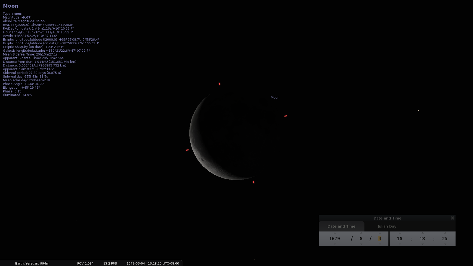
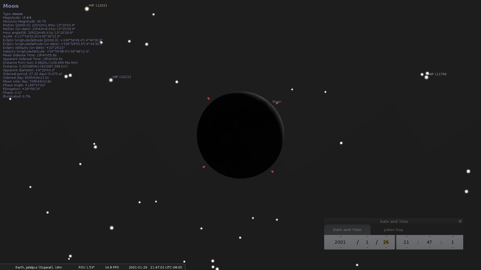
Until i'm done with the screenshots... Anyone can see Moon, distance from Earth and from Sun, and all the other parameters during any earthquake with these simple steps.
Install Stellarium http://www.stellarium.org/wiki/index.php/Installation
Start it.
Hit F11 to get into fullscreen.
Search for the Moon. <CTL><F> and type moon in the search box then enter.
Zoom with mousewheel until you like what you see.
Hit F5 to bring in the time window. Input the date of the earthquake.
Location doesn't matter so much. Moon is pretty much the same on all Earth within 24 hours or so.
But if you wanna be more accurate you can do so by bringing the location Window from the hidden menu on the left.
https://www.youtube.com/watch?v=NOGEyBeoBGM
]


No comments:
Post a Comment
Friendly comments welcome
Note: Only a member of this blog may post a comment.